
Charleston ZIP Code Directory Coverage
These are the USPS and local postal associations documented for Charleston. The physical city crosses postal and county lines, so the table is an address-verification starting point rather than a map of municipal neighborhoods. The Post Office column reports the documented postal-city label or delivery character, not a station name. Research did not identify a current official facility-by-facility list for each code.
| ZIP | Areas Covered | Post Office | Notes |
|---|---|---|---|
| 29401 | Downtown and peninsula context | Charleston postal city | Large-city grouping; verify exact address |
| 29402 | Charleston local listings | Postal or PO-box-type city code | Do not map as a neighborhood |
| 29403 | Upper peninsula context | Charleston postal city | Check City jurisdiction separately |
| 29405 | Charleston and North Charleston routing | Shared metro postal geography | Not a City-limits proxy |
| 29406 | Charleston and North Charleston routing | Shared metro postal geography | Verify Daniel Island or Cainhoy by address |
| 29407 | West Ashley context | Charleston postal city | City and County overlay can vary |
| 29409 | Charleston USPS grouping | Postal or unique-type code | Confirm physical delivery scope |
| 29410 | Charleston USPS grouping | Postal or unique-type code | Not a broad residential claim |
| 29412 | James Island context | Charleston postal city | Postal and municipal geography differ |
| 29413 | Charleston USPS grouping | Postal or unique-type code | Address-level verification needed |
| 29414 | West Ashley context | Charleston postal city | Some postal space is outside City limits |
| 29415 | Charleston USPS grouping | Postal or unique-type code | Do not treat as a neighborhood |
| 29416 | Charleston USPS grouping | Postal or unique-type code | Do not treat as a neighborhood |
| 29417 | West Ashley postal group | Charleston postal grouping | USPS groups it with 29407 |
| 29418 | Charleston and North Charleston routing | Metro postal geography | Verify City boundary by address |
| 29419 | Charleston USPS grouping | Postal or unique-type code | Address-level verification needed |
| 29420 | Charleston and North Charleston routing | Metro postal geography | Not a City-limits proxy |
| 29422 | Charleston USPS grouping | Postal or unique-type code | Do not map as residential area |
| 29423 | Charleston USPS grouping | Postal or unique-type code | Do not map as residential area |
| 29424 | Charleston USPS grouping | Unique or institutional-type code | Verify its delivery role |
| 29425 | Charleston USPS grouping | Unique or institutional-type code | Verify its delivery role |
| 29455 | Johns Island postal area | Johns Island delivery area | City territory can carry this label |
| 29492 | Daniel Island and Cainhoy context | Charleston postal grouping | Check City and County line per address |
Charleston ZIP code directory results are strongest when read alongside an exact address. A large-city group, PO-box-type code, or unique code may appear under Charleston without describing a broad delivery neighborhood. The USPS result and City mapping are the documented way to resolve that uncertainty.
Charleston ZIP Code Delivery Is Not Residency
A ZIP Code is a USPS delivery-routing designation. It does not confirm that a person or company is at the address, establish parcel ownership, or decide whether an address is inside the City of Charleston. USPS also notes that its standardized display can differ from the input. Use postal output for mail formatting, then shift to the City and County sources that answer jurisdiction and property questions.
- ZIP Code and ZIP+4
- A ZIP Code identifies a postal routing area. ZIP+4 adds a more specific delivery segment.
- PO-box ZIP
- A postal code associated with PO-box or mailing service, which should not be assumed to describe a physical neighborhood.
- Unique ZIP
- A code associated with a particular delivery role or institution and requiring address-level confirmation.
- Carrier route
- A mail-delivery grouping used by USPS, not a city boundary or a list of residents.
This distinction is a local practical issue. A Charleston mailing city can cover land outside the City, while City territory can carry another postal locality. The County Parcel Viewer, City MAPNET, and USPS each answer a different part of the address question.
Note: Postal formatting and municipal jurisdiction are separate facts, so retain the source and date for each address check.
Verify Charleston ZIP Code Addresses With USPS
Use the USPS ZIP Lookup in By Address mode for a particular street and number. The service also has a city-and-state route and a Cities by ZIP route. By Address is the better choice for record research because it returns the standardized delivery form for the known address. It still does not prove who lives there, who owns the parcel, or whether the address is municipal Charleston.
| USPS field or mode | Use in a Charleston check |
|---|---|
| Street Address | Required for By Address; enter the physical mailing address |
| City and State | Required components for By Address |
| Apt, Suite, or Other | Optional secondary-address field |
| ZIP Code | Optional when validating a known address |
| By City and State | City-and-state-to-ZIP route, not address confirmation |
| Cities by ZIP | ZIP-to-city route; ZIP is required |
Save the standardized response and retain the street number, direction, unit, city, state, and postal code. If the lookup does not return a usable result, recheck the physical address rather than substituting a nearby ZIP. USPS has no resident or parcel result screen to fill that gap.
Move a Charleston ZIP Code to Records
A ZIP narrows the mail question, not a resident list. Once USPS has standardized an address, move to the parcel and jurisdiction tools. This is the documented Charleston ZIP code workflow for a property, historic-address, or civic-record question.
- Run USPS By Address for the exact Charleston street and number, and save the standardized result.
- Use City MAPNET or What Jurisdiction Am I? to determine whether that address is in the City.
- Search the County Auditor or Parcel Viewer by the exact address or TMS, preserving parcel and owner facts without treating a mailing address as occupancy.
- Use City CSS or Document Search for City permits, plats, or code material, and the Register of Deeds for recorded instruments.
- For older people or address questions, move the exact address to CCPL reverse directories, maps, and ward research. ZIP Codes cannot solve a historic-number mismatch.
After an address is verified, the Charleston street directory provides the separate street-by-street record chain. That work begins with the address and parcel, not a ZIP-wide resident result.
Charleston ZIP Code Property Tools Have No Filter
Neither the County Auditor legacy property form nor the County Parcel Viewer exposes a ZIP filter. The Auditor documents owner-name, street-number and street-name, TMS, and sales-date paths. The Parcel Viewer accepts parcel number, address, street name, or owner name. City CSS uses a City address or prefixed parcel TMS, while City Document Search uses address, TMS, ordinance, street, or plat. None should be presented as a ZIP-wide property or resident search.
Charleston County’s Parcel Viewer accepts the address, street, owner, or parcel keys used after postal verification.
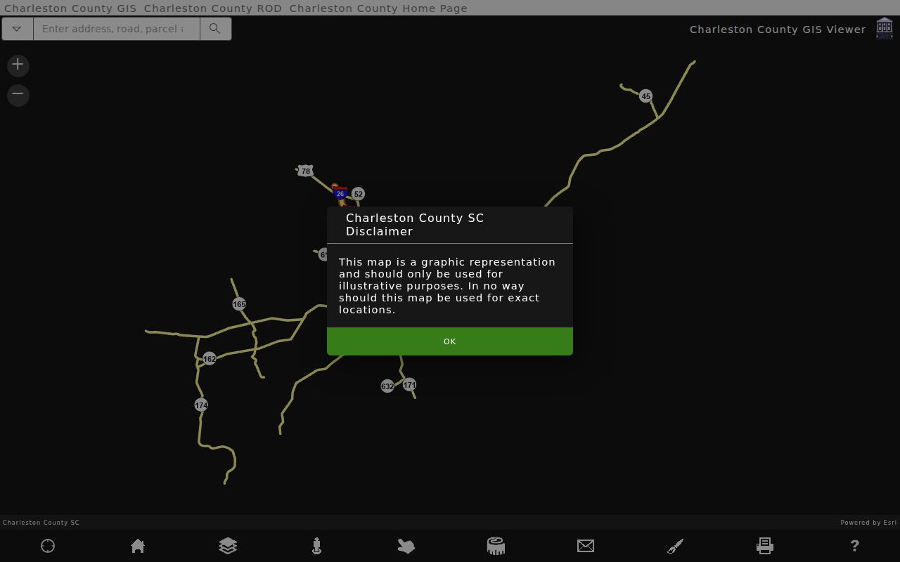
The selected parcel can link to tax information and show map context, parcel boundaries, labels, or measurement tools. It does not create an occupancy register. For a ZIP-related address, it is the handoff after USPS, not a replacement for USPS.
Charleston ZIP Code Geography Across Counties
Charleston’s records geography reaches beyond a compact peninsula. City territory includes Peninsula, West Ashley, James Island, Johns Island, Daniel Island, and Cainhoy, while the City also extends into Berkeley and Dorchester counties. That history explains why a historical City record, a County parcel, a postal city, and a municipal label may not all match. Records research must first identify which government body covers the exact location.
29407 and 29414 give West Ashley context, while 29412 gives James Island context. 29455 is a Johns Island postal area even though City territory can use that mailing label. 29492 is associated with Daniel Island and Cainhoy context. These descriptions help frame a search but do not remove the need for address-level verification.
Note: City expansion and multiple county jurisdictions make the parcel’s jurisdiction field and City mapping essential companions to postal data.
Check Charleston ZIP Code City Limits
The postal areas 29405, 29406, 29418, and 29420 interact with North Charleston metro geography. A Charleston ZIP code or mailing label in those areas does not establish that an address sits inside Charleston City limits. For an exact address, USPS provides mail routing, City MAPNET checks municipal reach, and County parcel data supplies the property key. Those are three separate checks.
City fire and GIS resources identify similar uncertainty in other metro ZIPs. A City permit or map result should be interpreted only after confirming City jurisdiction. County-wide Register of Deeds records also remain important where the City source does not govern the parcel. A ZIP result never changes the custodian responsible for the underlying record.
Charleston ZIP Code Unique Labels
Several codes in the Charleston USPS grouping are described only as postal, unique-type, or institutional-type codes in the available research: 29402, 29409, 29410, 29413, 29415, 29416, 29419, 29422, 29423, 29424, and 29425. They are included so a postal query does not appear to omit them. The research does not support assigning each one a neighborhood boundary or a particular physical facility.
Use USPS By Address to confirm a physical delivery address, if one exists. If the question then concerns a property, use the address or TMS with the Auditor and County GIS. If the question concerns City-held permits or plats, first confirm municipal jurisdiction and then use the City address or TMS search route.
Charleston ZIP Code History Starts Later
ZIP Codes do not solve historic Charleston address research. City directories and reverse sections, ward books, Sanborn maps, plats, and deeds have their own geographic systems. The Charleston Archive documents several early renumberings, a major 1884 through 1886 citywide project, an incomplete 1901 centigrade plan, and 1983 corrections. A current postal format may therefore be a poor search key for an older residence.
For an older address, compare the street number with adjacent directory names and ward-book order before deciding that the location moved. CCPL holds historic directory, map, and related material, while the Register of Deeds uses people and legal descriptions for older conveyance research. The path is address, parcel or historic lot, jurisdiction, and date, not a modern ZIP code alone.